
Urban Intelligence by Boldstreet
ONFIX
The Urban Brain
Modern cities are complex adaptive systems. Traffic congestion, emergency delays, broken utilities, flooding—these are not isolated problems. They are signals of a city operating without unified intelligence. ONFIX is that layer.
Nine Integrated Capabilities
The Urban Brain
ONFIX integrates nine interconnected systems that turn fragmented urban data into unified intelligence. Every system operates with adaptive responsiveness, learning from real-time conditions to optimize city operations.
Advanced Traffic Analytics Engine
Deep mobility intelligence across every lane and corridor
ONFIX delivers comprehensive traffic insight, analyzing vehicles per lane per minute, average speed per segment, queue length modeling, stop-start volatility, vehicle composition tracking, lane utilization efficiency, intersection delay modeling, signal phase performance, and pedestrian/cyclist flow tracking.
Real-Time Corridor Analytics: Short-horizon forecasting (0–60 min) for congestion build-up, event-driven surge modeling, peak stress forecasting, rainfall impact simulation, and construction disruption modeling.
Medium-horizon modeling captures weekly mobility patterns, seasonal flow variations, holiday surge anticipation, and climate event forecasting.
Long-horizon scenario planning includes urban growth projections and infrastructure expansion simulations.
Key Capabilities


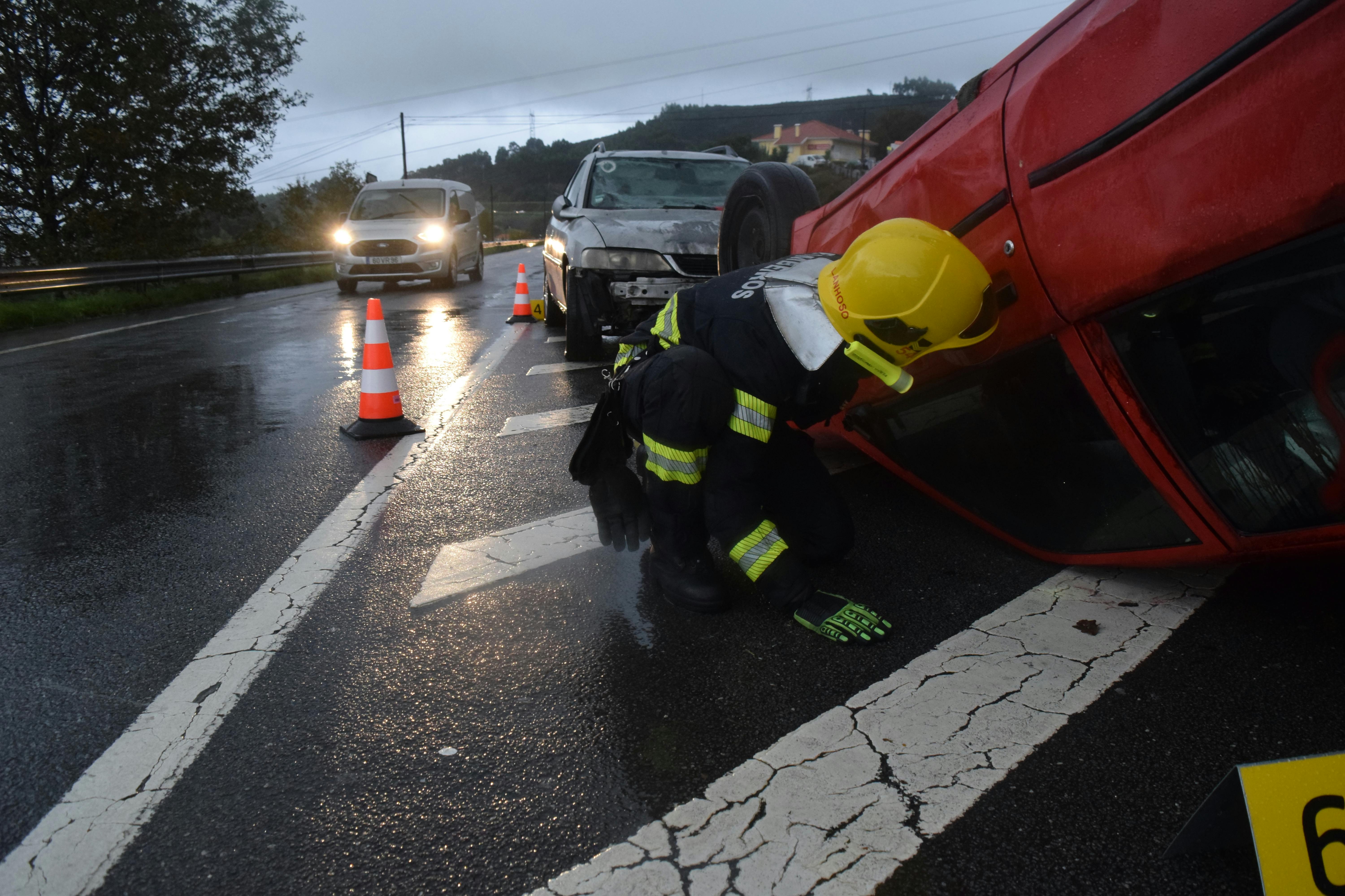
Accident Detection & Auto-Orchestration
Detect incidents, automatically optimize response and coordinate rescue
ONFIX detects accidents through sudden deceleration signatures, multi-vehicle stoppage clusters, abnormal density spikes, AI-powered video anomaly detection, obstruction modeling, and crowdsourced incident reports. The system automatically classifies incident severity, identifies nearest emergency services, optimizes dispatch routes, triggers traffic light priority, reroutes surrounding traffic, notifies hospitals based on capacity, logs forensic timelines, and activates nearby surveillance drones for verification.
Automatic Detection: Sudden deceleration signatures, multi-vehicle clusters, abnormal density spikes, thermal irregularities, obstruction modeling, AI video analysis.
Intelligent Orchestration: Severity classification, dispatch route optimization, traffic light preemption, automatic rerouting, hospital notification, forensic logging.
Advanced Integration: Drone verification, nearby surveillance activation, emergency response coordination across multiple agencies.
Key Capabilities

Utility & Infrastructure Monitoring
Protect every asset: power, water, telecom, and critical systems
ONFIX monitors power transformers, substations, streetlight clusters, water pipelines, sewer systems, fiber backbone routes, telecom towers, fuel depots, smart grid components, and renewable energy installations. It detects vandalism patterns, transformer tampering, illegal water tapping, pressure anomalies, sudden power load irregularities, dark-zone lighting failures, cyber intrusions, and structural integrity degradation through vibration sensors. All incidents automatically escalate to appropriate authorities with optional aerial verification.
Comprehensive Asset Monitoring: Power transformers, substations, streetlights, water pipelines, sewer systems, fiber networks, telecom infrastructure, fuel depots, solar/wind installations.
Vandalism & Threat Detection: Pattern recognition, tampering alerts, illegal tapping detection, pressure anomalies, cyber threat identification on infrastructure.
Smart Response: Automatic escalation, aerial verification via RAVEN integration, pattern analysis for prevention.
Key Capabilities

Emergency & Medical System Federation
Multi-agency coordination for faster, smarter emergency response
ONFIX integrates ambulance dispatch, hospital ER capacity, fire brigade systems, police response, emergency call centers, telemedicine hubs, and wearable health device feeds. The system enables ambulance ETA optimization, real-time hospital load balancing, multi-casualty routing, evacuation modeling, traffic signal preemption, disaster surge coordination, pandemic hotspot tracking, and mental health crisis mapping.
Integrated Emergency Network: Ambulance dispatch, hospital capacity, fire brigades, police, emergency centers, telemedicine hubs, health wearables.
Optimization Capabilities: ETA optimization, capacity balancing, multi-casualty routing, evacuation planning, traffic preemption.
Advanced Coordination: Disaster surge management, pandemic tracking, mental health crisis mapping, multi-agency federation with role-based access.
Key Capabilities


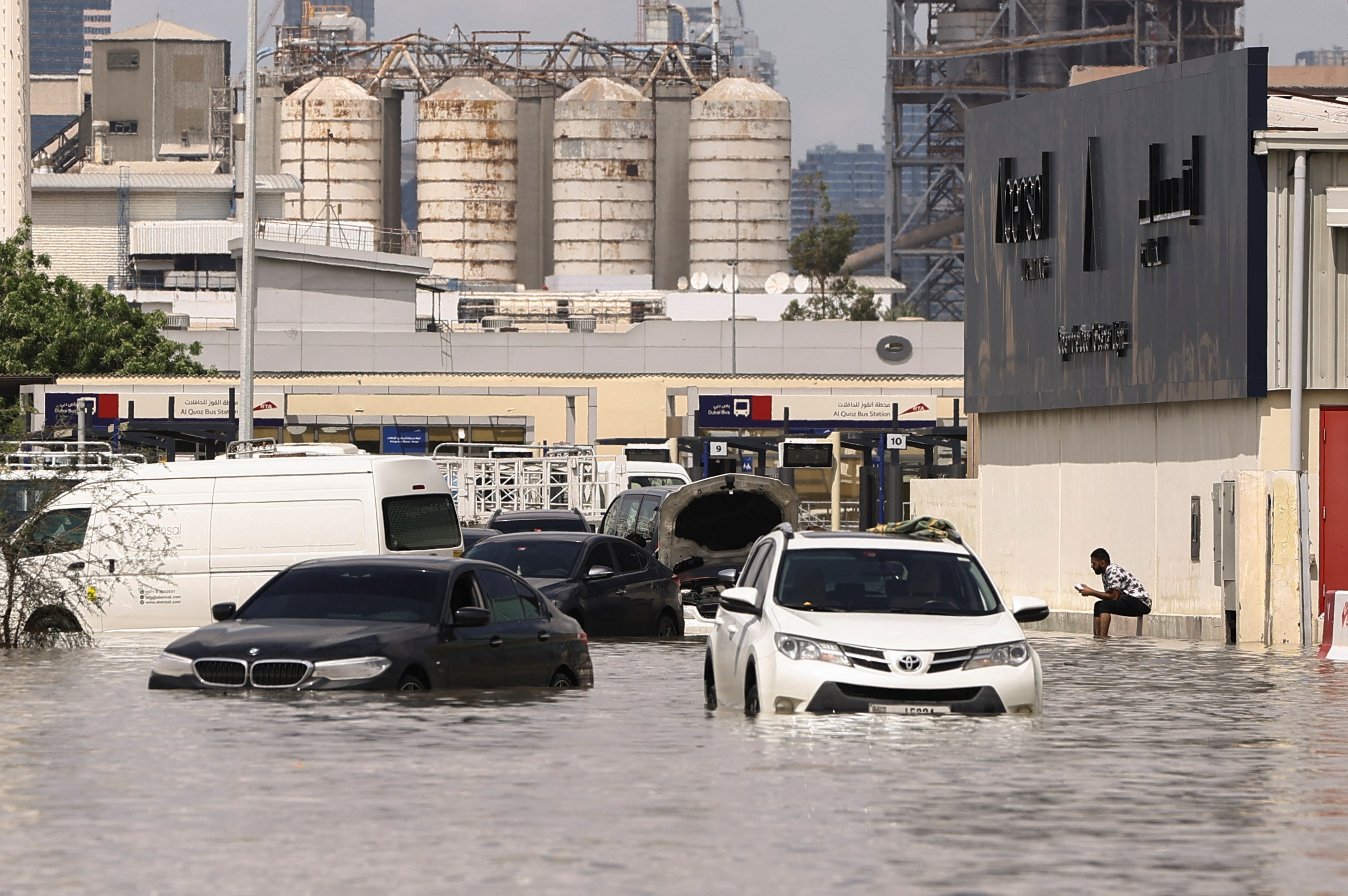
Disaster & Climate Resilience Engine
Detect, predict, and optimize response to climate crises
ONFIX continuously monitors flood-prone corridors, rainfall intensity, water-level sensors, heatwave thresholds, air pollution spikes, power outage overlays, landslide-prone zones, earthquake early-warning systems, and wildfire risk modeling. The system provides flood corridor auto-closure recommendations, evacuation route optimization, shelter load balancing, relief vehicle priority routing, disaster logistics heatmaps, public advisory overlays, climate adaptation scenario planning, and carbon credit tracking.
Real-Time Monitoring: Flood corridors, rainfall, water levels, heatwaves, air quality, power outages, landslides, earthquakes, wildfires.
Predictive Intelligence: Event forecasting, impact modeling, surge anticipation, resource requirement planning.
Automated Response: Corridor closure recommendations, evacuation route optimization, shelter balancing, relief prioritization, logistics coordination.
Key Capabilities


Environmental & Public Health Analytics
Correlate emissions, health impacts, and urban sustainability
ONFIX correlates PM2.5 vs traffic density, NO₂ vs idle time, CO₂ vs heavy truck share, heat island intensification, noise pollution levels, and biodiversity impact from urban expansion. The system outputs emission-minimizing rerouting, idle reduction modeling, ESG dashboards, school-zone pollution protection, climate reporting modules, green space optimization recommendations, and vector-borne disease prediction.
Integrated Health Monitoring: PM2.5, NO₂, CO₂ correlation with traffic patterns, heat mapping, noise pollution tracking, biodiversity assessment.
Optimization Outputs: Emission-minimizing routes, idle reduction, school zone protection, green space recommendations.
Reporting & Analytics: ESG dashboards, climate reporting, disease prediction, sustainability metrics, carbon tracking.
Key Capabilities

Enforcement & Vehicle Intelligence
Detect threats, track risks, coordinate enforcement
ONFIX integrates real-time ANPR (Automatic Number Plate Recognition), stolen vehicle watchlists, plate cloning anomaly detection, behavioral vehicle signature modeling, suspicious corridor recurrence tracking, drone-assisted pursuit guidance, facial recognition for high-risk individuals (privacy-compliant), and cyber vehicle hacking alerts. The system generates vehicle risk scores, high-risk corridor heatmaps, organized mobility cluster detection, traffic violation predictive policing, and routes alerts to authorized police dashboards with role-based access.
Advanced Detection: ANPR integration, stolen vehicle tracking, plate cloning detection, behavioral signatures, recurrence analysis.
Threat Intelligence: Risk scoring, corridor heatmaps, organized cluster detection, predictive policing, cyber threat alerts.
Enforcement Integration: Drone coordination, facial recognition (privacy-compliant), secure police dashboards, role-based access control.
Key Capabilities

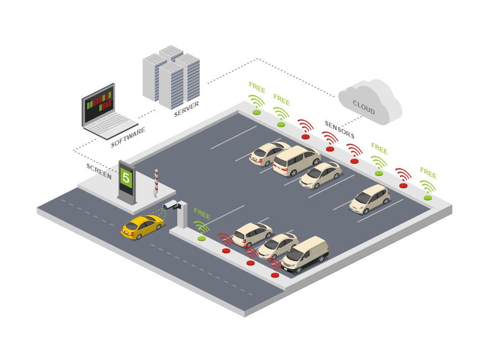
Smart Parking & Mobility Hubs
Reduce circling traffic and optimize urban mobility
ONFIX reduces circling traffic and urban clutter with real-time parking spot availability, dynamic pricing models, reservation systems, integration with ride-sharing apps, and multi-modal hub optimization (bus, bike, EV). Features include parking violation auto-detection and integration with mobility networks for seamless urban transportation.
Real-Time Availability: Live parking spot tracking, dynamic pricing intelligence, reservation systems, multi-modal integration.
Mobility Optimization: Ride-sharing app integration, bus-bike-EV hub coordination, violation auto-detection.
Urban Impact: Reduced circling traffic, lower emissions, improved accessibility, seamless multi-modal journeys.
Key Capabilities
Commercial District & Economic Visibility
Monitor commercial activity, protect assets, track economic health
ONFIX models footfall density, market congestion, shop corridor night-time anomalies, glass-break/gunshot acoustic signatures, repeated burglary cluster mapping, informal vendor density heatmaps, retail transaction flow analytics, tourism hotspot monitoring, and event crowd management. The system enables commercial district protection, insurance intelligence, urban economic performance monitoring, retail planning, supply chain disruption alerts, and local business sentiment analysis via social feeds.
Commercial Monitoring: Footfall tracking, market congestion analysis, shop corridor anomalies, acoustic threat detection, burglary cluster mapping.
Economic Analytics: Vendor density mapping, transaction flow analysis, tourism tracking, crowd management, sentiment analysis.
Business Intelligence: District protection, insurance data, performance monitoring, retail planning, supply chain insights.
Key Capabilities


Command & Control
The ONFIX Operations Hub
ONFIX is the unified nervous system that cities have been missing. Traffic systems, emergency services, medical networks, enforcement units, utility infrastructure, and disaster monitoring—all integrated into one intelligent platform.
Our multi-agency command federation gives traffic authorities, police, fire, hospital operators, disaster managers, utilities, and civic leadership role-based access to the same real-time intelligence. Cities operate faster, safer, and smarter.
Built for sovereignty. Edge-cloud hybrid. On-premise deployment available. Regional failover. Complete data protection. ONFIX respects your city's digital independence.
200+
Cities Connected
1M+
Daily Events Processed
99.9%
System Uptime
Real-World Impact
Case Studies & Insights
Cities worldwide are transforming how they operate with ONFIX. Real data. Real results. Real impact.
Toronto: Reducing Emergency Response Time by 18% with Unified Dispatch Intelligence
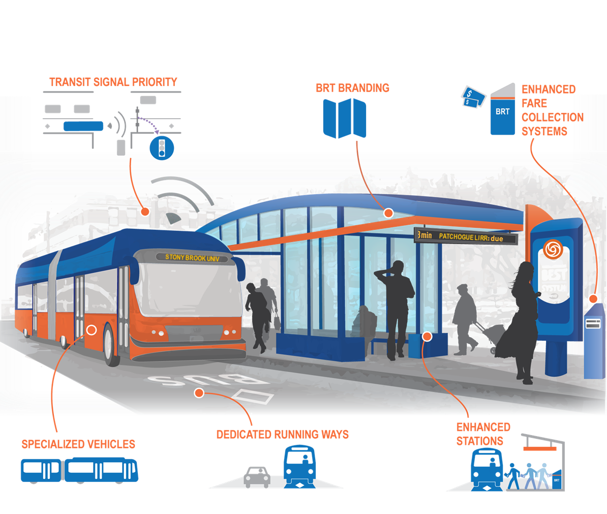
Lagos: Using ONFIX to Manage BRT Network Congestion During Peak Hours
White Paper: Multi-Agency Command Federation in Disaster Response Systems
Jakarta: Predictive Flood Monitoring and Evacuation Route Optimization
Partner with us
Transform Your City Today
ONFIX is deployed in 200+ cities across 6 continents. Let's discuss how unified intelligence can solve your city's most pressing challenges.
Founded By
Boldstreet
Urban Intelligence Design
ONFIX is created and stewarded by Boldstreet, a team of city systems engineers, data scientists, and emergency responders.
Global Deployment
200+ cities connected
1M+ events processed daily
99.9% system uptime
Edge-cloud hybrid. On-premise capable. Your data sovereignty.
Powered by
Advanced analytics, AI/ML, real-time processing, digital twin simulation, multi-agency federation, RAVEN integration for security escalation, blockchain-secured transactions, and zero-trust cybersecurity.